Auction No 349, Category: Maps
7 Lots (displaying 1 - 7)
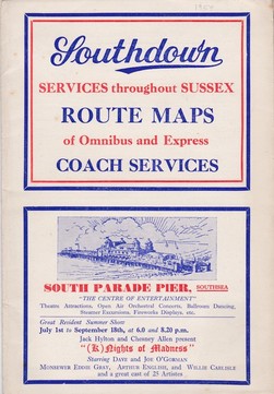
Southdown Sussex Route Maps of Omnibus and Express Coach Services
Southdown Sussex Route Maps of Omnibus and Express Coach Services
Lot 37
Lot: 37
- Auction Date: Wed 11th Mar 2015 12:00 GMT (Ended)
- Est: £20 - £30
SOLD £26
MORE DETAILSSouthdown Sussex Route Maps of Omnibus and Express Coach Services, 1954, large folding map, card cover, VG; and various books on UK buses, largely Ian Allan h/b publications. (12)
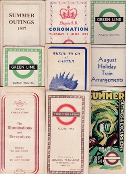
London Transport Bus & Coach Maps 1935-1970
London Transport Bus & Coach Maps 1935-1970
Lot 41
Lot: 41
- Auction Date: Wed 11th Mar 2015 12:00 GMT (Ended)
- Est: £30 - £50
SOLD £38
MORE DETAILSLondon Transport Bus & Coach Maps 1935-1970, including special issues; plus bound timetables for 1957 and 1967. Good to fine. (30)
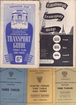
Blackpool Tram & Bus Timetables (3) and Fares Tables, 1960-62
Blackpool Tram & Bus Timetables (3) and Fares Tables, 1960-62
Lot 43
Lot: 43
- Auction Date: Wed 11th Mar 2015 12:00 GMT (Ended)
- Est: £30 - £40
SOLD £52
MORE DETAILSBlackpool Tram & Bus Timetables (3) and Fares Table, 1960-62; Blackpool and Edinburgh Tram & Bus Maps/Guides; and various Tram histories (10) mostly h/bk.
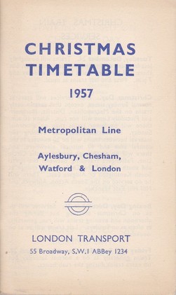
London Transport Timetables and Bus Maps
London Transport Timetables and Bus Maps
Lot 54
Lot: 54
- Auction Date: Wed 11th Mar 2015 12:00 GMT (Ended)
- Est: £30 - £40
SOLD £42
MORE DETAILSLondon Transport Timetables and Bus Maps, plus timetable amendment leaflets, 1924 (poor) to modern; includes Metropolitan Line Christmas Timetable for 1957, Country Bus Timetables for 1962 & 1964, etc. (60+)
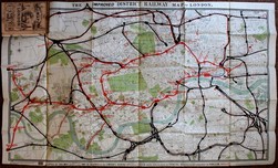
The Improved "District Railway" Map of London, 1879
The Improved "District Railway" Map of London, 1879
Lot 73
Lot: 73
- Auction Date: Wed 11th Mar 2015 12:00 GMT (Ended)
- Est: £80 - £120
SOLD £80
MORE DETAILSThe Improved "District Railway" Map of London, W.J. Adams & Sons, 1879, large folding coloured sheet map, 35.5 x 42", with 30pp of advertisements on reverse, complete with pictorial wraps and in worn leather pouch. Fine & Scarce. (The extension to Whitechapel, completed in 1884, is shown as a proposed line).
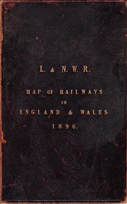
L. & N.W.R. Map of Railways in England and Wales 1896
L. & N.W.R. Map of Railways in England and Wales 1896
Lot 74
Lot: 74
- Auction Date: Wed 11th Mar 2015 12:00 GMT (Ended)
- Est: £40 - £50
UNSOLD
MORE DETAILSL.& N.W.R. Map of Railways in England and Wales 1896, large sectional fold-out linen-backed sheet map, 41.5 x 41", hand-coloured in outline, very good. Leather-covered boards, gilt, front cover detached.
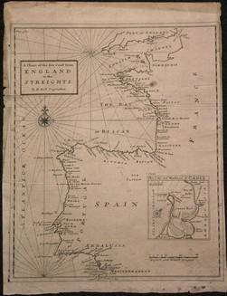
H. Moll "A Chart of the Sea Coast from England to the Streights" c.1750
H. Moll "A Chart of the Sea Coast from England to the Streights" c.1750
Lot 106
Lot: 106
- Auction Date: Wed 11th Mar 2015 12:00 GMT (Ended)
- Est: £20 - £40
SOLD £135
MORE DETAILSH. Moll A Chart of the Sea Coast from England to the Streights, c.1750, with inset of Cadiz harbour, 33.5 x 28cm. The border dust affected & slightly frayed, the map unaffected. Small fox mark.