Auction No 364, Category: Maps
5 Lots (displaying 1 - 5)
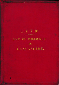
Railway Company publications and handbooks 1920s to 1960s, including L & Y. Map of Collieries in Lancashire,
Railway Company publications and handbooks 1920s to 1960s, including L & Y. Map of Collieries in Lancashire,
Lot 15
Lot: 15
- Auction Date: Wed 14th Dec 2016 12:00 GMT (Ended)
- Est: £50 - £70
SOLD £135
MORE DETAILSRailway Company publications and handbooks 1920s to 1960s, including L & Y. Map of Collieries in Lancashire, Railway Athletics Association Yearbooks 1920s (2); various LMS including Working Timetable Appendix 1931, Management of Stations 1931, Signalling 1947; etc. Also leaflets & ephemera. Large qty. (abt. 6.5 kilos) Generally good to fine.
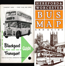
Bus Maps 1960s to 2000s, all decades well represented, mostly English companies or corporations.
Bus Maps 1960s to 2000s, all decades well represented, mostly English companies or corporations.
Lot 27
Lot: 27
- Auction Date: Wed 14th Dec 2016 12:00 GMT (Ended)
- Est: £20 - £30
SOLD £32
MORE DETAILSBus Maps 1960s to 2000s, all decades well represented, mostly English companies or corporations. Mainly good to VF (70)
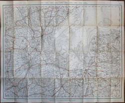
Box of folding-maps from 1828, mostly cloth-backed, mostly Gall & Inglis Half-Inch Maps of England (29),
Box of folding-maps from 1828, mostly cloth-backed, mostly Gall & Inglis Half-Inch Maps of England (29),
Lot 42
Lot: 42
- Auction Date: Wed 14th Dec 2016 12:00 GMT (Ended)
- Est: £30 - £40
SOLD £30
MORE DETAILSBox of folding-maps from 1828, mostly cloth-backed, mostly Gall & Inglis Half-Inch Maps of England (29), and other early-20th Century. Mainly good to Very Good. (40)
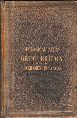
"Reynold's Geological Atlas of Great Britain" James Reynolds, 2nd Edn, [1868], original gilt cloth,
"Reynold's Geological Atlas of Great Britain" James Reynolds, 2nd Edn, [1868], original gilt cloth,
Lot 44
Lot: 44
- Auction Date: Wed 14th Dec 2016 12:00 GMT (Ended)
- Est: £50 - £60
SOLD £72
MORE DETAILSReynold’s Geological Atlas of Great Britain James Reynolds, 2nd Edn, [1868], original gilt cloth, faded, spine with small repair; contemp.ownership signatures; damp staining to text margins but the hand-coloured plates all fine and complete
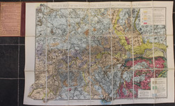
James Wyld "Wyld's Map of the Superficial Geology of London and its Environs" 1870
James Wyld "Wyld's Map of the Superficial Geology of London and its Environs" 1870
Lot 45
Lot: 45
- Auction Date: Wed 14th Dec 2016 12:00 GMT (Ended)
- Est: £30 - £40
SOLD £36
MORE DETAILSJames Wyld Wyld’s Map of the Superficial Geology of London and its Environs London, 1870, dissected folding map, cloth-backed, 19.5 x 28”, fine; cloth-bound, ink inscription on publisher’s label o/w VG.